China’s first water conservancy satellite, Shuili-1, has sent back its first images, capturing breathtaking views of the Yellow River in Inner Mongolia. This innovative satellite is designed to monitor water resources and help in natural disaster prevention, marking a significant leap in environmental monitoring.
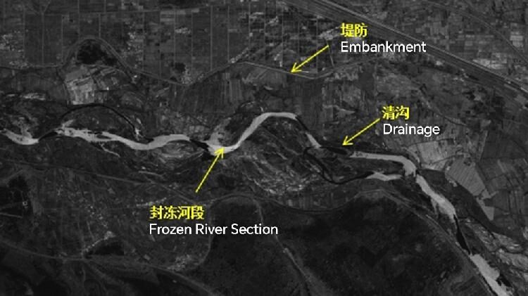
The images from Shuili-1 show frozen parts of the Yellow River, along with embankments and drainage systems in the Urad Front Banner region. These visuals are crucial for managing water resources and preparing for severe weather events like floods.
Shuili-1 was launched on December 17 from the Taiyuan Satellite Launch Center in Shanxi Province, along with three other synthetic aperture radar (SAR) satellites. Combined with four satellites already in orbit, they form a constellation that provides high-resolution radar images, any time of day, in all weather conditions.
“The satellite’s ability to see through clouds and rain makes it effective even during storms,” said Chen Deqing, director at the Ministry of Water Resources. “It can provide important data during extreme weather, helping us prevent and respond to disasters.”
These satellites are also smart—they can process data onboard and send the results directly, which makes everything faster and more efficient. The network should be fully up and running before next year’s flood season, giving real-time monitoring of rivers, lakes, and reservoirs across China.
By combining data from different sources, the satellite network will create specialized tools to support the water industry. This advancement means better water management and safety for communities that face flooding and other water-related challenges.
Reference(s):
cgtn.com


